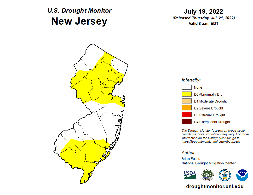
Drought conditions continue to stress crops in South-Central counties and a significant portion of northern NJ. Although the US Drought Monitor indicates conditions are only in the abnormally dry category, local conditions along the Pilesgrove-Upper Pittsgrove border west of the Salem River and adjoining areas of Gloucester County are experiencing moderate drought conditions in some fields; but not others due to the sporadic precipitation paths of recent storms. All stages of corn and soybeans in affected fields are showing signs of yield reduction due to disruption of pollination and seed set.

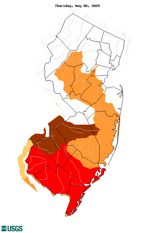
The USGS Below Normal 7-Day Average Streamflow Condition Map more accurately reflects a moderate hydrologic drought (darker orange colored area). A significant portion of the region has seen below normal precipitation for the past seven days. A streamflow which is less than the 25 percentile is considered below normal. The darker orange shaded areas of South-Central NJ of the USGS map represents 6-9 percentile stream flow activity.
Another way to observe increasing crop stress is to look at the cubic feet per second discharge of streams in the area since planting season. As seen in this graph of the Maurice River at Norma, NJ, current stream level discharge is well below the median daily discharge value over the past 88 years.
For information on USDA available drought related programs by commodity, see the poster:
Click to access farmersgov-disaster-assistance-brochure-07-21-2022.pdf


